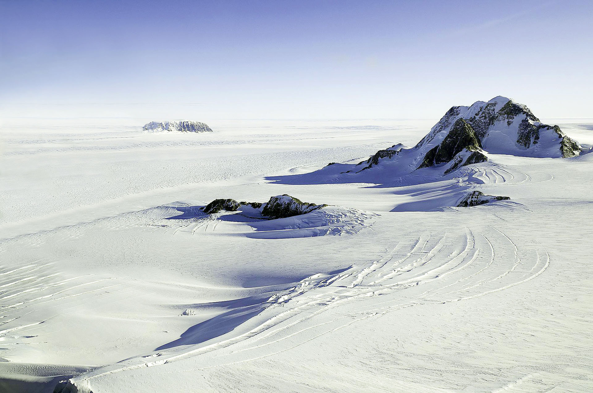
Hard Data to Collect

Antarctica is a remote and cold continent. The extreme temperatures mean that only hardy organisms can survive its harsh winters. Sometimes the only sound is the wind whipping across the frozen plains. Most of the land in Antarctica is covered by sheets of ice, and in some places, the ice is more than 4.8 kilometers (3.0 miles) thick. You might never suspect that deep under the ice, on this quiet, isolated continent, lies an active volcano, steadily rumbling.
Geologists previously thought that the only recently active volcanoes in Antarctica were Mt. Erebus and Deception Island. Both of these volcanoes are easily visible and have erupted in recent history, making them easy for scientists to observe and study. However, another volcano lurked under the ice, waiting to be discovered.
Between 2007 and 2010, a team of scientists installed a network of seismometers throughout the West Antarctic Ice Sheet and collected data to learn more about what going on underneath the ice.
(Jeremy Miner/POLENET)

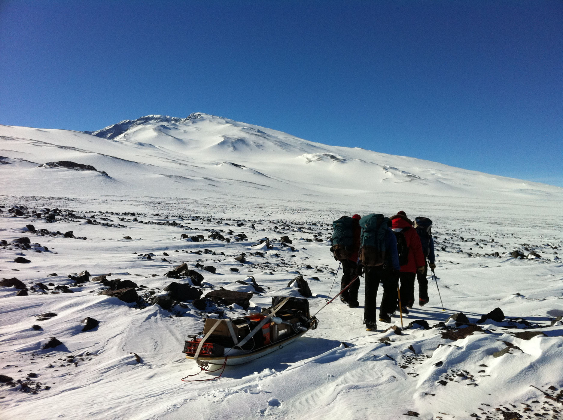
In 2007, a team of scientists installed a network of seismometers in the West Antarctic Ice Sheet. Installing seismometers in the harsh conditions of West Antarctica was no easy task. The researchers used snowmobiles to pull seismometers hundreds of miles across the ice sheet, braving the extreme conditions to set up their equipment. The team dug through thick layers of snow and ice to bury the seismometers at the correct depth. In 2010, a group of scientists made the difficult trip to retrieve the seismometers and collect the data.

The research team originally installed the seismometers to figure out the characteristics of the rock below the ice. The data told them a different, and surprising, story.

West Antarctica is slowly pulling away from East Antarctica, making a rift valley. Volcanoes can often be found in rift valleys. Scientists knew that West Antarctica used to have active volcanoes, but there was no evidence to suggest that any volcanoes were still erupting. However, between 2010 and 2011, the research team detected what are called earthquake swarms. An earthquake swarm is when many earthquakes of a similar size happen over a short period of time. These swarms were occurring between 25 and 40 kilometers (16 and 25 miles) deep in the ice sheet. Earthquakes at those depths may mean that magma is rising through Earth’s crust. Earthquake swarms sometimes happen underneath active volcanoes and may indicate that an eruption could happen soon.

Antarctica Earthquake Swarms

Map
Info 1
Info 2
Info 3
The majority of the continent of Antarctica is covered by sheets of ice. Scientists used a variety of evidence to infer what is going on underneath this ice. (Amanda Lough, PhD/POLENET)

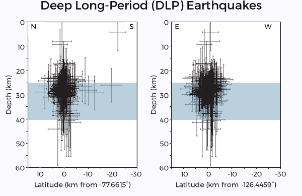
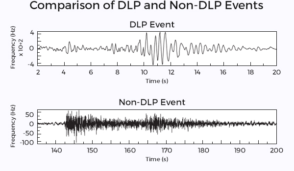
Without meaning to, the scientists had accidentally discovered an active volcano more than a kilometer beneath the ice sheet of West Antarctica.

If this volcano erupted in the near future, the lava would melt the ice surrounding the volcano. The scientific community was eager to find out how much ice would melt.

This topographic map shows the rock surface of Antarctica underneath the ice sheet.
(British Antarctic Survey/BAS/BEDMAP consortium)

The researchers who discovered the volcano say it would take a massive eruption, with a thousand times more energy than an average eruption, to melt the ice all the way to the surface. It is more likely that an eruption would simply cause a large volume of ice to melt – perhaps millions of gallons. This water would flow under the ice and drain to the sea.

What scientists don’t know is how that kind of melt might affect the ice shelf. Would future volcanic eruptions make the ice shelf unstable? Climate change is likely already contributing to glaciers shrinking in Antarctica. Could eruptions make the problem worse?

The West Antarctic volcano provides an incredible opportunity to research how an eruption could affect the overall environment of Antarctica. Perhaps even more importantly, it shows that even the iciest, quietest environments can have hidden fire within.

Scientists braved challenging conditions to study characteristics of the rock hidden beneath Antarctica's ice sheet.
(POLENET)

Tamu Massif

A Giant in the Deep

Investigate the largest volcano on Earth hidden far beneath the ocean.

The Mid-Atlantic Ridge

40,000 Mile Long Volcano

Investigate mid-ocean ridges and the fascinating life that thrives in this environment.

San Andreas Fault

Shake Alert

Investigate how technology is providing warning to residents living along the San Andreas Fault.

Maar Volcanoes

Unexpected Eruptions

Investigate one of the most unpredictable types of volcanoes in the world.

Fire Under the Ice

Volcanoes in West Antartica

Investigate how scientists detected potentially active volcanoes underneath sheets of ice in Antarctica.

Yellowstone

A Sleeping Supervolcano

Investigate the volcano lurking underneath one of the most popular national parks in the United States.

  • anomaly

    noun

    Something that is unexpected, abnormal, or differing from what is common.

  • crater

    noun

    A bowl-shaped hole in Earth's surface.

  • earthquake

    noun

    A sudden shaking of the ground producing seismic waves or vibrations, which may result in destruction. An earthquake occurs when slabs of rock suddenly slip past each other at a break in Earth's crust, called a fault.

  • geyser

    noun

    A type of hot spring that sends heated water and steam up into the air.

  • lava

    noun

    Hot, molten rock that has reached Earth's surface through volcanic eruption or a crack in the crust.

  • mid-ocean ridge

    noun

    A long line of mountains on the seafloor, formed by divergent plate boundaries and the upwelling of magma. Seismic and volcanic activity are common along these regions.

  • seismometer (or seismograph)

    noun

    A tool to measure the movement of the ground. This instrument can measure seismic activity, such as the force and duration of an earthquake.

  • tectonic plate

    noun

    Large, slowly moving, slab of solid rock that make up Earth's crust.

  • convergent boundary

    noun

    A location where tectonic plates collide with each other. When two continental plates push toward each other, they fold together and form mountain ranges.

  • crust

    noun

    The outermost layer of Earth. The crust is the coolest and thinnest layer of Earth, ranging from about 5 to 70 km thick. The crust is divided into large slabs of rock, called tectonic plates.

  • eruption

    noun

    Molten rock, ash, and steam ejected from a volcano or geyser.

  • horizontal

    adjective

    At a right angle to the vertical or parallel to the ground level.

  • maar

    noun

    A broad volcanic crater typically filled with water. Maars are created from the explosion that occurs when groundwater meets hot magma.

  • p-wave

    noun

    A type of seismic wave, called primary waves, because they are the first waves from an earthquake to reach a seismograph. P-waves are compressional waves, shaking the ground back and forth, towards and away from the direction the wave is traveling.

  • steam

    noun

    Water in the gas phase.

  • transform boundary

    noun

    A location where tectonic plates slide horizontally past one another. The plates grind together causing frequent earthquakes.

  • convergent with subduction boundary

    noun

    At convergent plate boundaries with subduction, plates push together, and one plate moves underneath the other. This type of boundary may result in the formation of trenches, volcanoes, islands, and earthquakes, which can trigger tsunamis.

  • divergent boundary

    noun

    A location where tectonic plates move away from one another. When plates move apart, lava and magma rise to the surface and make new rock. This type of boundary may result in the formation of small volcanoes, shield volcanoes and rift valleys.

  • fault

    noun

    A fracture or crack in the rocks that make up Earth's crust.

  • hydrothermal vent

    noun

    An opening in the sea floor where magma meets water. This interaction causes heated water, filled with minerals, to rise up from the opening.

  • magma

    noun

    Hot liquid or molten rock located beneath the surface of Earth.

  • seismic wave

    noun

    The vibration from an earthquake that travels within Earth or along Earth's surface.

  • s-wave

    noun

    A type of seismic wave, called shear waves or secondary waves, because they reach a seismograph and shake the ground second, after an earthquake occurs. S-waves shake the ground perpendicularly to the direction the waves are traveling.

  • volcano

    noun

    An opening in Earth's crust which releases hot gases and molten rock.